Project “MPC-3D” for 3D modeling and areal survey of sea-bed is supported by NTI
 New MARINET project is supported by NTI – Development of multi-purpose software-hardware complex for 3D modeling and areal survey of sea-bed for the purpose of mineral resources exploration and engineering-geological support for the construction of underwater structures. The project budget is 15 MUSD including 8,25 MUSD of government support within the NTI.
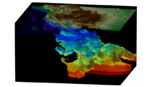
A multi-purpose hardware-software complex is developed by Marine Innovarion Ltd. for high-precision 3D modeling of sea-bed structure for the purpose of mineral resources exploration and monitoring, as well as for for conduction of engineer-surveys on the shelf consisting of the following inter-related modules:
– Low-frequency, narrow-beam echo sounder – profiler with data primary processing and management system for drawing-up the depth profiles of sea-bed sediments sub-bottom penetration up to 500 meters with depth resolution 5-50 sm (depending on the depth);
– Parametric multi-beam side-scan sonar with space frequency tinting, data primary processing and management system for drawing-up the model of seas-bed relief and upper layers of sea-bed sediments with sub-bottom depths up to 50 meters with range resolution 7-10 sm;
– Hardware-software complex for entire system management, accumulation, processing and reflection of obtained hydro-acoustic, seismic-acoustic and auxiliary information and sea-bed 3D modeling in a real-time mode;
– Super-computer with hybrid architecture based on Inter and NVidia solutions with 3D visualization system and problem-oriented computation systems simulation tools for processing big volume of hydro-acoustic and seismic-acoustic data.
Research-engineering novelty of the project:
- Implementation of a new method of ultra-wideband acoustic signals beaming with application of non-linear interaction. Outcome: Bigger depths of penetration into sea-bed sediments (500m) with simultaneously high resolution capability (from 5 sm)
- Implementation of a new scanning method – “frequency tinting” of space (simultaneous beaming of orthogonal complex signals in broad sector with spot beams). Outcome: identification of physical and mineralogical features of sea-bed grounds, highlighting of needed features in a real-time mode.
- Implementation of the side-scanning method for scanning under the sea-bed surface over the seabed structures. Outcome: 3D-picturing of sea-bed structures allocation in a real-time mode.
- Implementation of new methods on consolidation, filtration and processing of obtained information in a real-time mode (quality control). Outcome: acquisition of primary outcomes of trials with assessment of their suitability for further processing and compliance with the required quality standards.
- Implementation of procedures on the analysis of compliance of forecast data (obtained from the models) with the real data for disclosure of environment heterogeneities. Outcome: high-performance identification of heterogeneities and exploration characteristics of studied objects (making decision on entering the object into the system master data base or highlighting thereof).
- Implementation of a new standard (format) of submittal and reflection of in situ data Outcome: creation of unified information-master database for presentation, study, interpretation of the geological structure and its anomalies on the shelf.

 Русский